Post by bsimon615 on Sept 29, 2018 15:28:54 GMT -6
I have always (3 trips so far) gone up to the White Horse Christian Retreat one way and come back another way. My way up is one way that at least partially will be the route followed by many of you coming from the west, and my way home will partially cover the route followed by some of you headed home to the east. I will tell you the way that I go, but for best results, please check your route using MapQuest or a similar program.
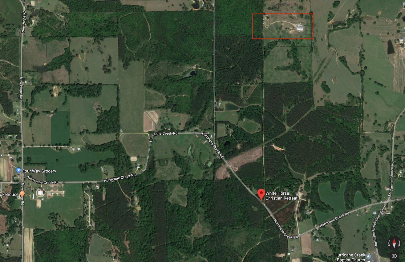
For me, living near the intersection of Canal Blvd. and Robert E. Lee Blvd. in New Orleans, I head west on Robert E. Lee Blvd., transitioning to Old Hammond Hwy and crossing into Jefferson Parish at the 17th St. Canal. I can continue on to Lake Ave. and turn left there, and head south to West Esplanade Ave, right on West Esplanade for about 2 miles to Causeway Blvd. Right on Causeway and then crossing Lake Pontchartrain on the Causeway and then continuing straight when the roadway turns into LA 190 toward Covington. You/I/we then veer right onto LA 21 in a northeasterly direction and then north when it turns north at Bush. Straight north on LA 21 past Varnado and Angie. The road turns into MS 35 at the state line. Continue north for about 7.25 miles past the state line. Look for a large pond near the 7 mile mark, you will also notice a green arched bridge. Just past the pond you will turn left onto Hurricane Creek Rd. and continue on it for approximately 3.25 miles. You will come to the sign for the White Horse Christian Retreat Camp (315 Hurricane Creek Rd., Sandy Hook, MS) on a fence in front of you. Turn to the right here and continue north for approximately 1 mile to the entrance to the White Horse Christian Retreat.
Headed home I retrace my steps, but instead of veering to the right on LA 21 toward Covington, I stay straight and follow the directions to Pearl River, LA, and then on to Slidell via a short stretch of I-59 and then I-10 at Slidell and on in to New Orleans.
Going up, the distance for me is about 91 miles and headed home it is 96 miles.
Once again, verify the best route for you using MapQuest or some other program. Travel time is about 90 minutes for me.
Barry Simon
Attachments: